In short
- Problem: people planting on their own land choose species by habit or a nursery's advice. A wrong choice costs years, not days: the trees die and the money is gone.
- What I did: defined a deliberately narrow first version, designed the flow and built a working beta that pulls live climate, terrain and soil data for any point.
- Where it is: a public beta covering one validated pilot region, with the species catalogue under review.
The problem
The data needed to choose a tree well already exists: decades of temperature records, elevation models, soil maps and records of where species grow. It is just scattered across scientific services and written for specialists. A landowner who wants shade or fruit on 200 square meters cannot use any of it.
The risk is uneven, too. In northern Iran, conditions change quickly between the humid coastal lowlands and the Alborz slopes a few kilometers away. A species that thrives in one place can fail in the next.
The principle: being wrong is expensive
Most of the product decisions follow from one sentence: a wrong recommendation means dead trees and wasted money. That made caution a feature, not a disclaimer.
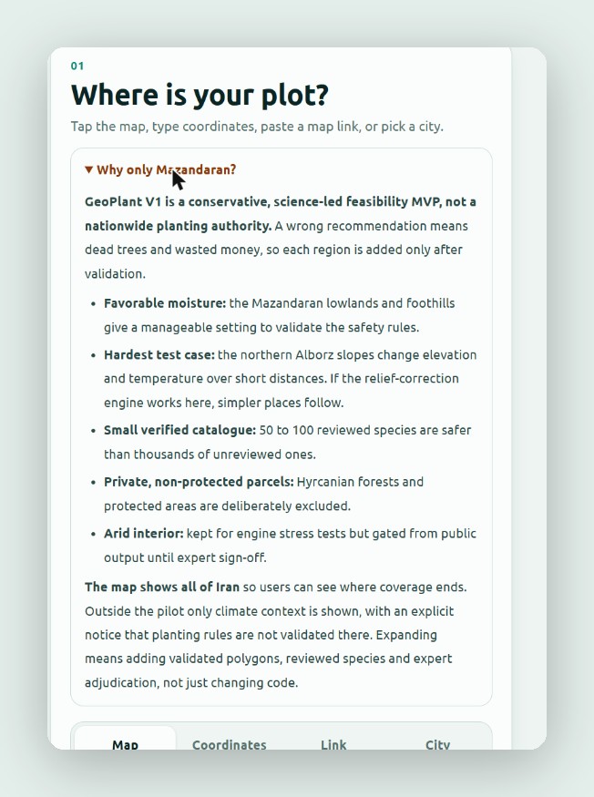
- One pilot region, on purpose. Version one covers the Mazandaran lowlands and foothills, where the rules can be checked. The map still shows all of Iran so people can see where coverage ends; outside the pilot it shows climate only, with a clear notice.
- "Don't know" is always an answer. Every question accepts it, and a "don't know" makes the result more cautious. The tool never fills a gap with a guess.
- AI helps with the form, never with the verdict. You can describe your land in a sentence and AI fills in the questionnaire. It does not rank or recommend species; the rules do.
- Protected land is excluded. Hyrcanian forests and protected areas are left out of planting advice entirely.
The flow
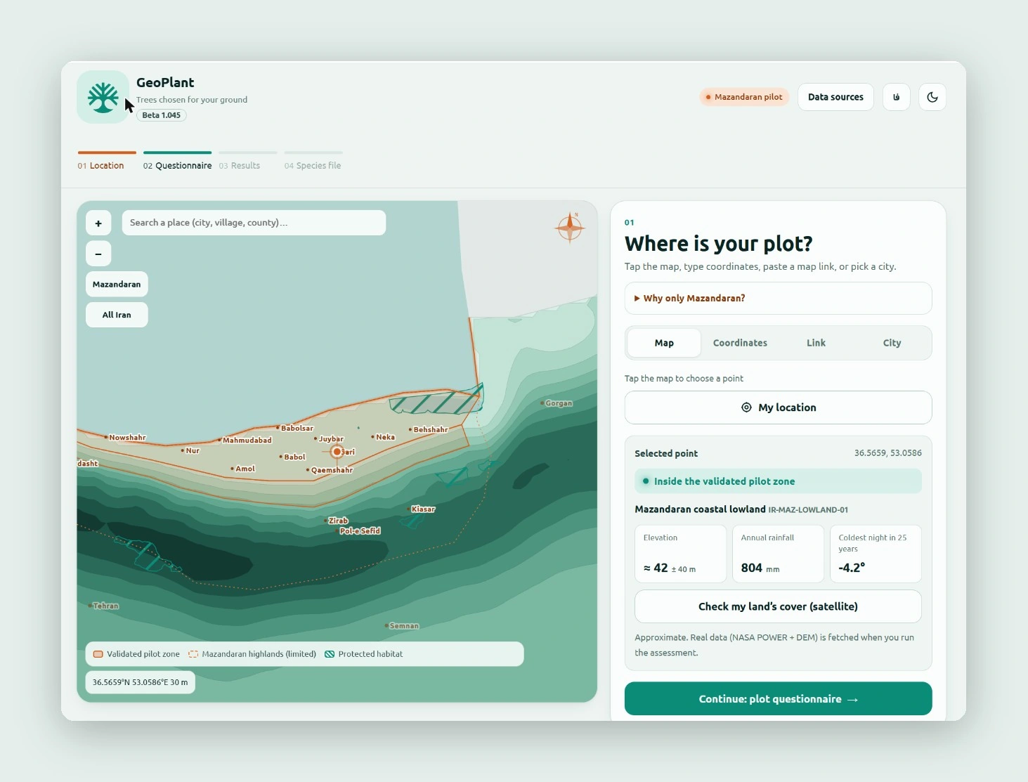
Four steps, shown as a progress bar: Location → Questionnaire → Results → Species file.
1. Location
Tap the map, type coordinates, paste a map link or pick a city. The tool confirms whether the point is inside the validated zone and previews elevation, rainfall and the coldest night in 25 years before you answer anything.
2. Questionnaire
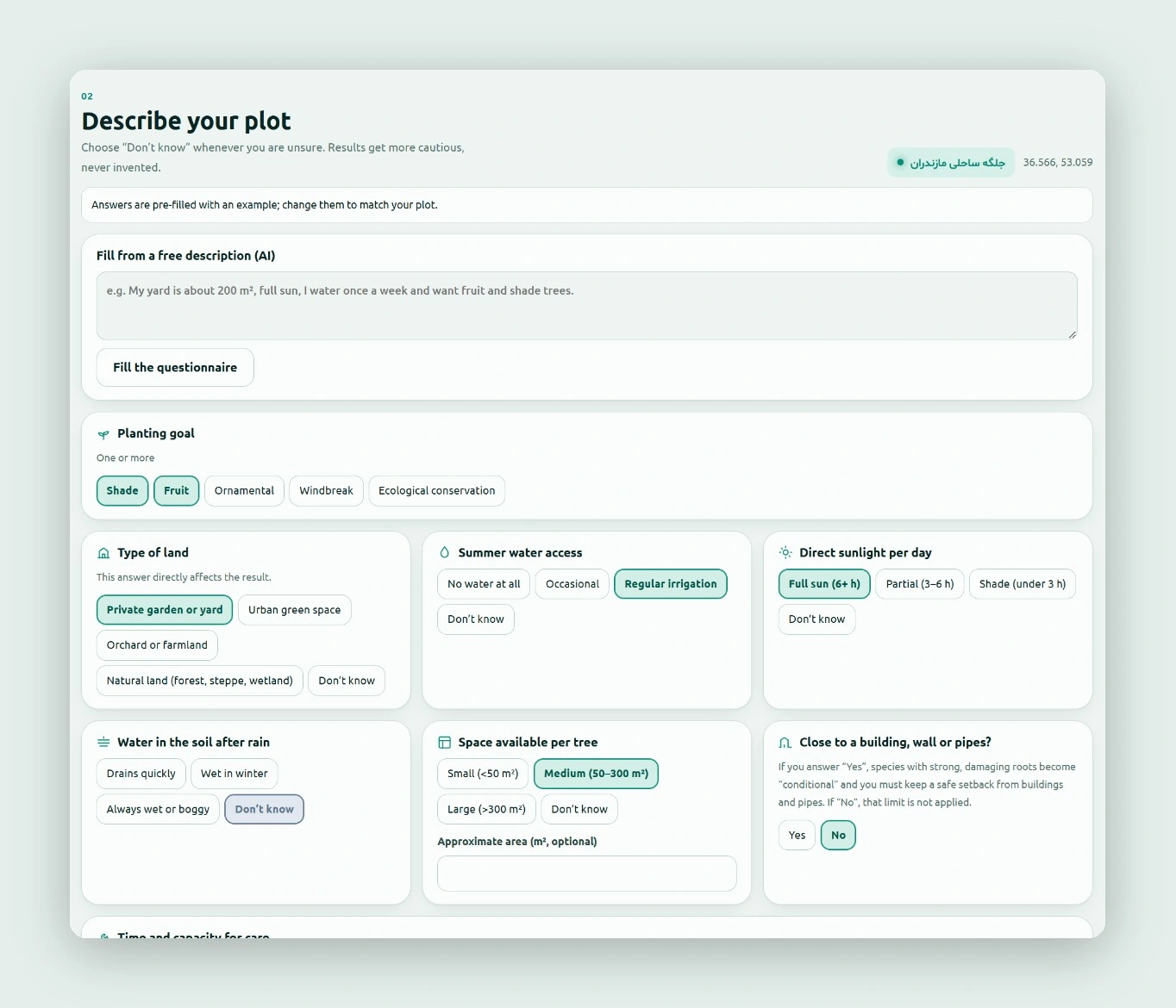
Eight short questions about the land, each with plain options: what you want from the trees, type of land, summer water, sunlight, drainage after rain, space per tree, nearby buildings or pipes, and how much care you can give. Answers that change the result are labelled as such.
3. Results
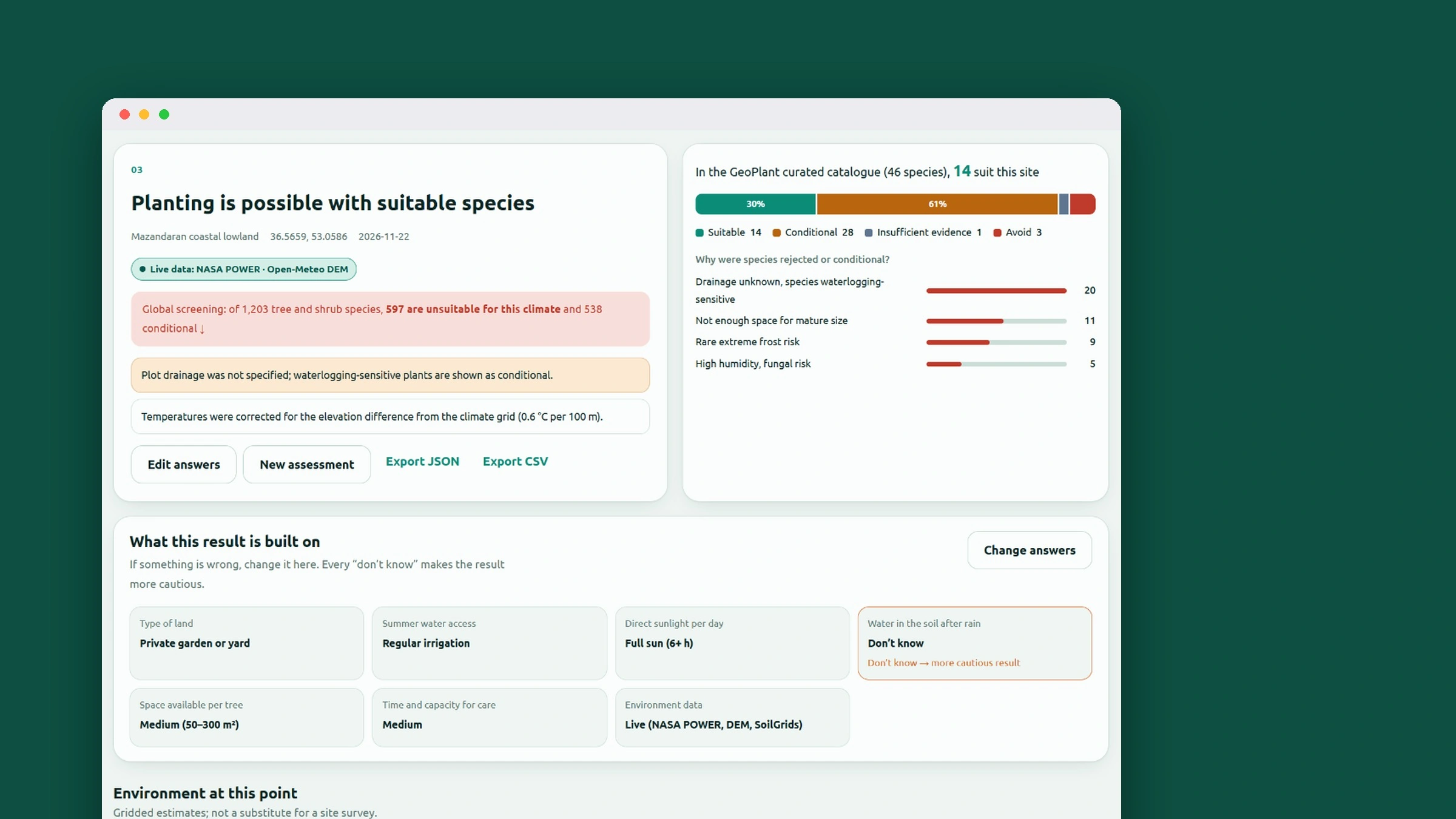
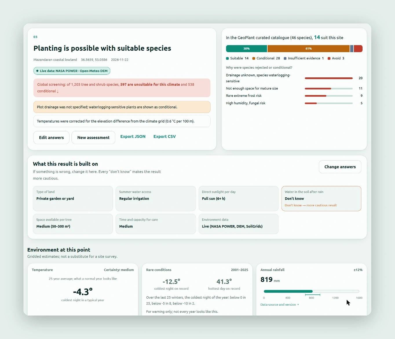
The result leads with the answer, then shows its working. For the sample plot, a first screening of 1,203 tree and shrub species rules out 597 as unsuitable for the climate. Of the 46 species in the reviewed catalogue, 14 are suitable, 28 conditional, 3 to avoid and 1 lacks evidence, and the reasons are ranked (unknown drainage is the most common one).
Under the verdict, What this result is built on lists every answer, with the uncertain ones highlighted and editable in place, so the user can see exactly which answer to improve.
4. Species file
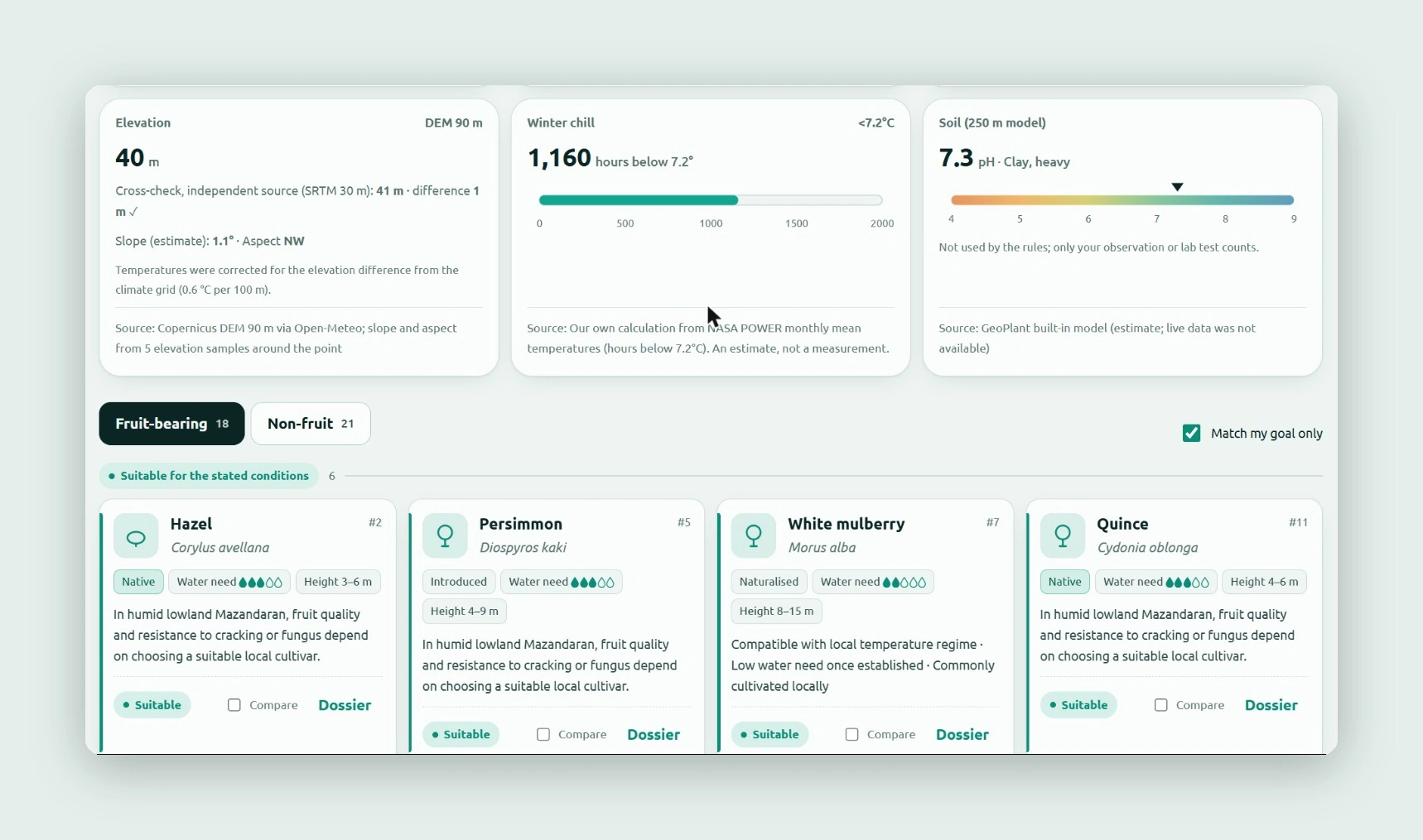
Each species card shows whether it is native, introduced or naturalized, its water need and mature height, and a short local note. Every environment figure on the page names its source and its certainty; elevation, for example, is cross-checked against a second terrain model.
Making the data visible
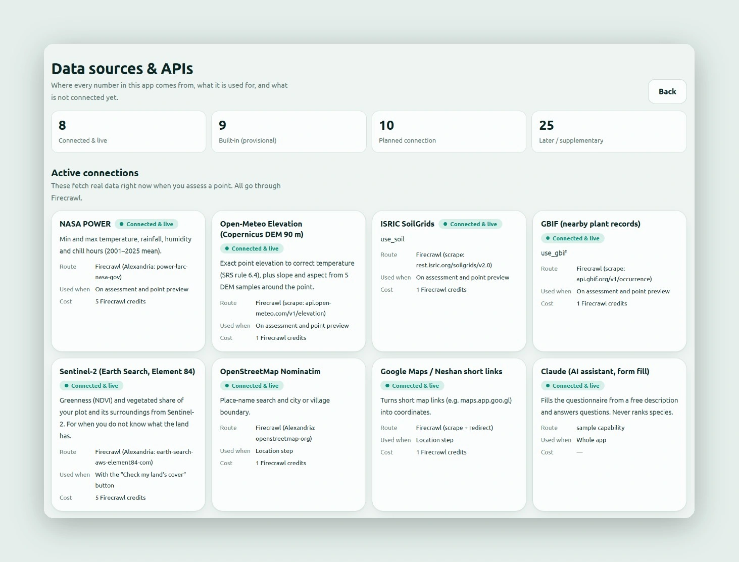
A tool that asks people to plant on its word has to show where its numbers come from. A Data sources page lists every source: 8 connected and live (including NASA POWER climate data, Copernicus elevation, ISRIC SoilGrids, GBIF plant records and Sentinel-2 imagery), 9 built-in and provisional, 10 planned and 25 for later. Results can be exported as JSON or CSV.
What is next
- Expert review of the species catalogue: 50 to 100 reviewed species are safer than thousands of unreviewed ones.
- Soil tests as an input, since the soil model is an estimate and is not used by the rules yet.
- New regions only after their zones and species are validated, not just by changing code.
- What I will measure: how often each question gets a "don't know" (to find the questions people cannot answer), how many plots fall outside the pilot (to choose the next region), and how many results are exported or revisited.